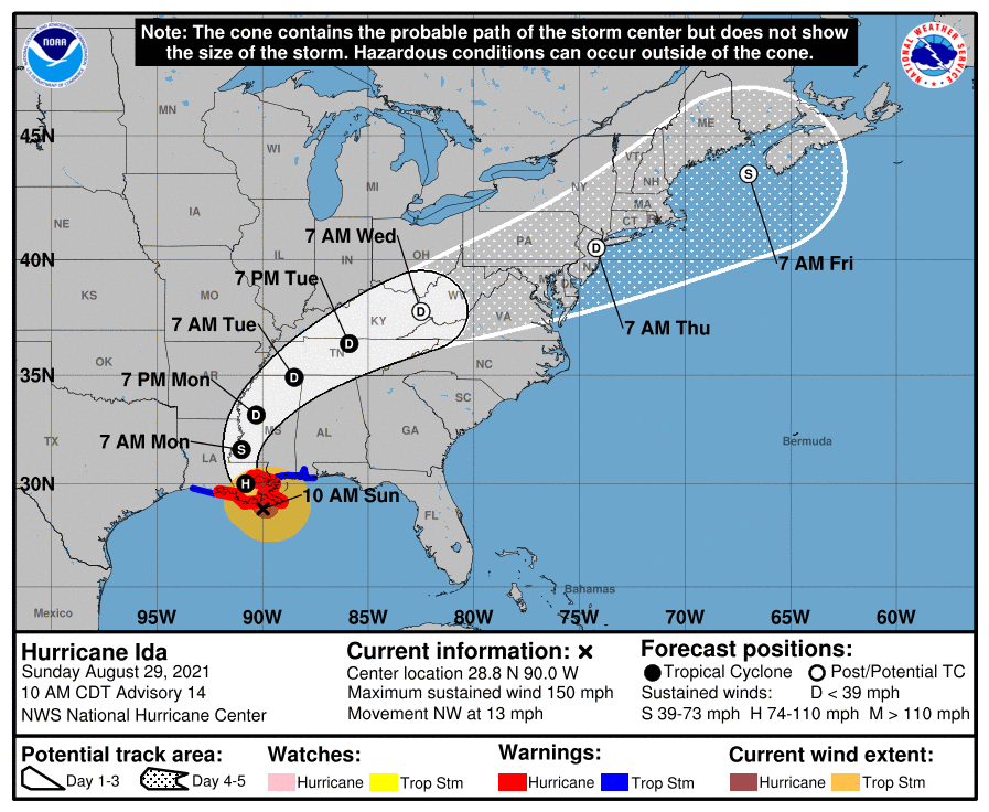
NOAA Doppler radar imagery indicates that the eye of Ida made
landfall along the southeastern coast of Louisiana near Port
Fourchon around 1155 AM CDT (1655 UTC). Data from an Air Force Reserve reconnaissance aircraft and Doppler radar data indicate that Ida’s maximum sustained winds at landfall were estimated to be 150 mph (240 km/h). The latest minimum central pressure estimated from reconnaissance aircraft data is 930 mb (27.46 in).

Within the past hour, sustained winds of 43 mph (69 km/h) and a
gust to 67 mph (107 km/h) were reported at Lakefront Airport in New Orleans.
A NOAA National Ocean Service tide gauge in Shell Beach, Louisiana, recently reported a water level of 6.4 feet above mean higher high water, which is an approximation of inundation in that area.
A NOAA National Ocean Service tide gauge at Bay Waveland Yacht Club,Mississippi, recently reported a water level of 5.5 feet above meanhigher high water, which is an approximation of inundation in that area.